


- What is a topographic map?
- Get a topographic map without a 3D Printer
- What 3D printing technology works best for a 3D Terrain?
- Apps and Sites for Terrain models
- Tips for making your Relief Printable
- How else landscape models can be made
What is a topographic map?
Topographic maps are the maps that represent a relief of the Earth or another cosmic body. In 2D versions, equally elevated areas on topographic maps are connected with a contour. 3D versions of the maps, also called terrain models, allow to recreate the physical relief on a smaller scale. Starting as a tool for military planning, topographic maps are now mostly used for science and architecture.
Another way of capturing the environment is landscape models, which focus on showcasing the scenery of areas. Used in architecture, landscape models include reliefs, vegetation, buildings and even animals based on the desired application. They walk hand in hand with topo maps but commonly add more to them, making a relief filled with life.
Topo maps and landscape models are also used outside of their fields. The three-dimensional versions are fancied as décor and art pieces as they allow to capture the beauty of natural curves.
Order Topographic map 3D Printed
If you don’t have a 3D printer at home, order a terrain piece from our services. Simply drop your STL into the widget to get instant pricing and delivery estimates.
What 3D printing technology works best for a 3D Terrain?
Relief models are seemingly simple-looking. However, in order to preserve the grace of terrain, it is critical to get the smooth transitions of curves. For this application, our Top-3 printing technologies would be:
FDM
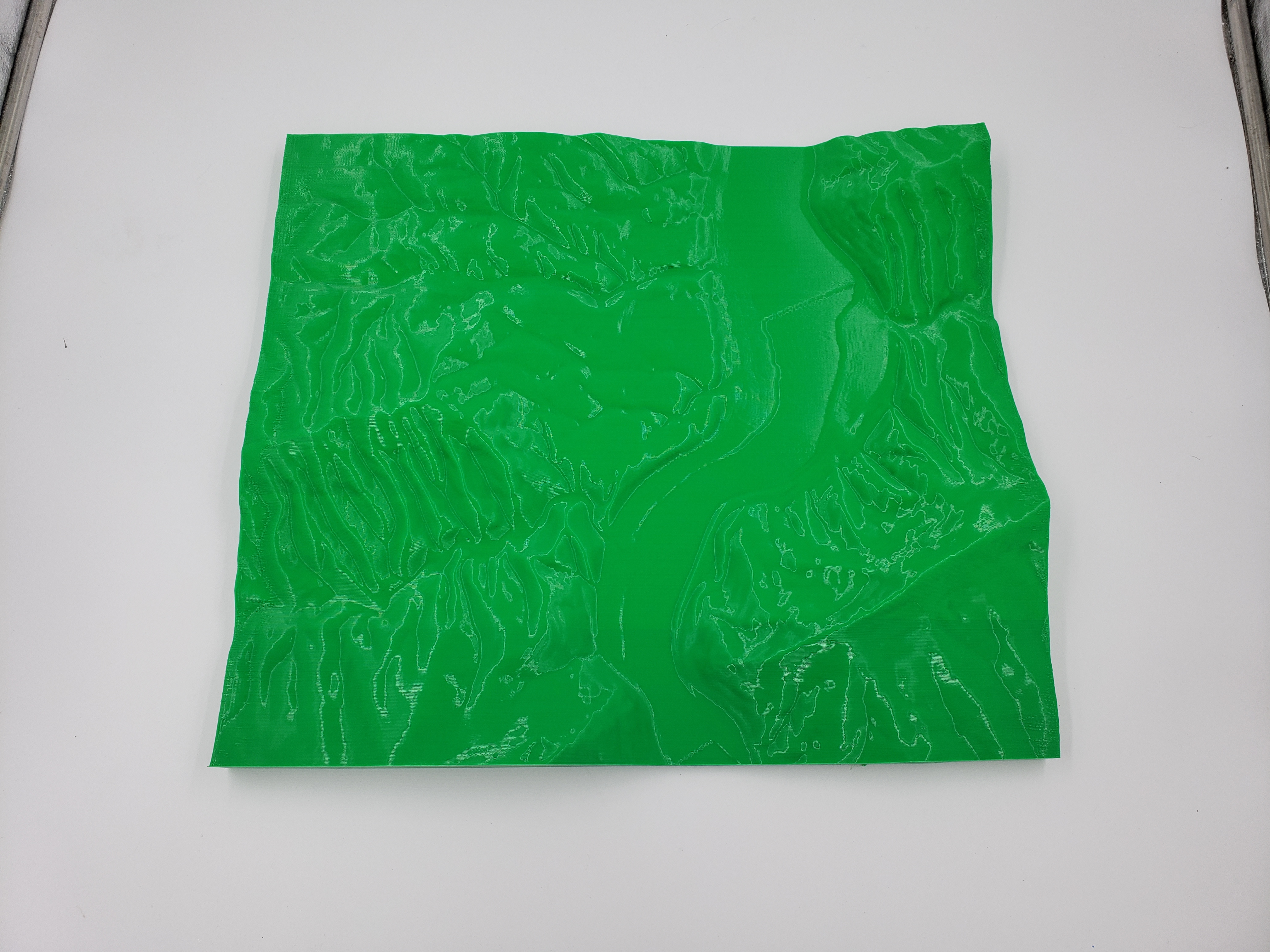
FDM uses plastic filaments to form objects with a wide range of geometries possible. Desktop plastic modeling may easily deliver poor results on topo maps with too many intricate details. However, if a 3D terrain is properly scaled and optimized with a decent flat base and enough layer thickness, results stand pretty strong. PLA would be the best choice for the material as it provides less trouble when printing and transferring details well.
- - Layer lines on the surface would be inevitable.
- - Details thinner than 0.5 -1 mm would not come out.
- - Monochrome.
- + The most affordable technology for smaller projects.
- + Relatively quick.
SLS
SLS is a technology that creates parts from powder grains, mostly polyamides. This method suits terrain and landscape models really well, especially bigger ones, which can be printed as single pieces. Fused grains also deliver really beautiful and smooth surfaces with great precision. Going with general-purpose powders like PA12 will be ideal.
- - Hollow models will need to have escape holes.
- - Non-coated SLS objects are yellow over time and absorb moisture.
- - Higher 3D Printing costs.
- + Great accuracy and surface quality.
- + Bigger terrain models are possible to get in one run.
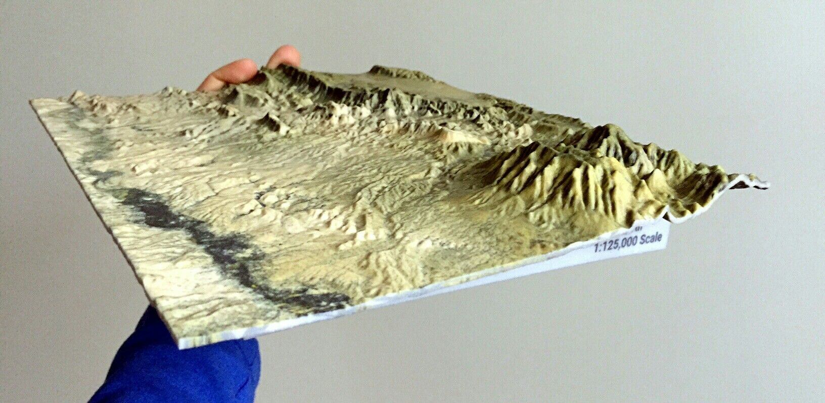
Image credits: ghopper
CJP
While CJP also runs on powder, it uses a binding agent to fuse the grains like sandstone. The resulting models are more fragile but on a good note - colorful. With the CMYK palette possible, CJP can create fully colored landscape models and topo maps. The smallest of the color details may be a bit blurred, so we won’t recommend having tiny text on the terrain. But larger colored areas will turn out nicely.
- - Models are fragile and require a coating to preserve details and colors.
- + Accurate maps in full color are possible.
Apps and Sites for Terrain models
To get a topo model printed, you will need an STL model, OBJ or another 3D file format. It can be designed manually in suitable software like Blender, Rhino and Solidscape or generated with specially developed apps and sources. Some of the popular and user-friendly are:
Terrain2STL – is a free and open-to-use service for getting models for terrains. Based on Google maps, it can generate a finished file of any surface available through Google’s database.
TouchTerrain is a similar tool, developed by combined forces of Iowa and Kansas Universities It includes more complicated settings, including sun angles.
ReliefMode – generates bas reliefs and lithophanes from 2D images. It allows getting relief of any surface you have a picture of, not limiting you to Earth’s current geology. Though, it will be less accurate due to working from a picture.
Moon2STL – a relative of Terrain2STL, this is the same service but for Moon, which is rich with fascinating craters and hills.
Libraries with ready-to-print models are another, hassle-free way to go. Many designs are available in general-type libraries like Thingiverse, Cults3D, Sketchfab and others.
If you aren’t afraid to take a bit more challenging route, you can explore field-specific databases, which contain Digital Elevation Models. Some of these include OpenTopography and OpenStreetMap. DEMs are a digital representation of terrain received from satellites, lidar data, photos or other equipment. In order to get from DEM to STL, you can use GIS software for converting.
One final option we have for you is the Equator. This online tool allows you to create a markup at any place on the Earth and then export it as a .dwg file. Then, you can convert it to STL in AutoCAD or using an online converter.
How to make your map 3D Printable
The quality of a 3D printed landscape starts from a properly optimized and printable model. So, if possible, after generating your relief, try to make it suitable for your printing method.
For FDM
- Aim to reduce the number of overhangs and angles less than 45 degrees to the base;
- Keep the details over 1.15 mm or at least 0.5 mm;
- Ensure a model's wall thickness of 1.2 mm at least;
- For text, prefer thicker fonts and opt for 1 mm depth/height for it.
For SLS and CJP
- Hollow enclosed parts are not possible, thus, include holes or model parts solid;
- Recommended detail size is bigger than 0.8 mm;
- Suggested wall thickness is around 0.7 mm - 2.0 mm;
- For text details, ensure depth/height about 2 mm.
Other manufacturing methods for terrains
When plastic doesn’t feel right for you, it is worth exploring other ways to manufacture a terrain model. At Treatstock, we can offer you:
Laser Cutting – a great way to get a flat map or relief contours from woods and acrylics;
CNC milling – for three-dimensional terrains and landscapes from woods, foams and metals.